
Historical map of Azerbaijan

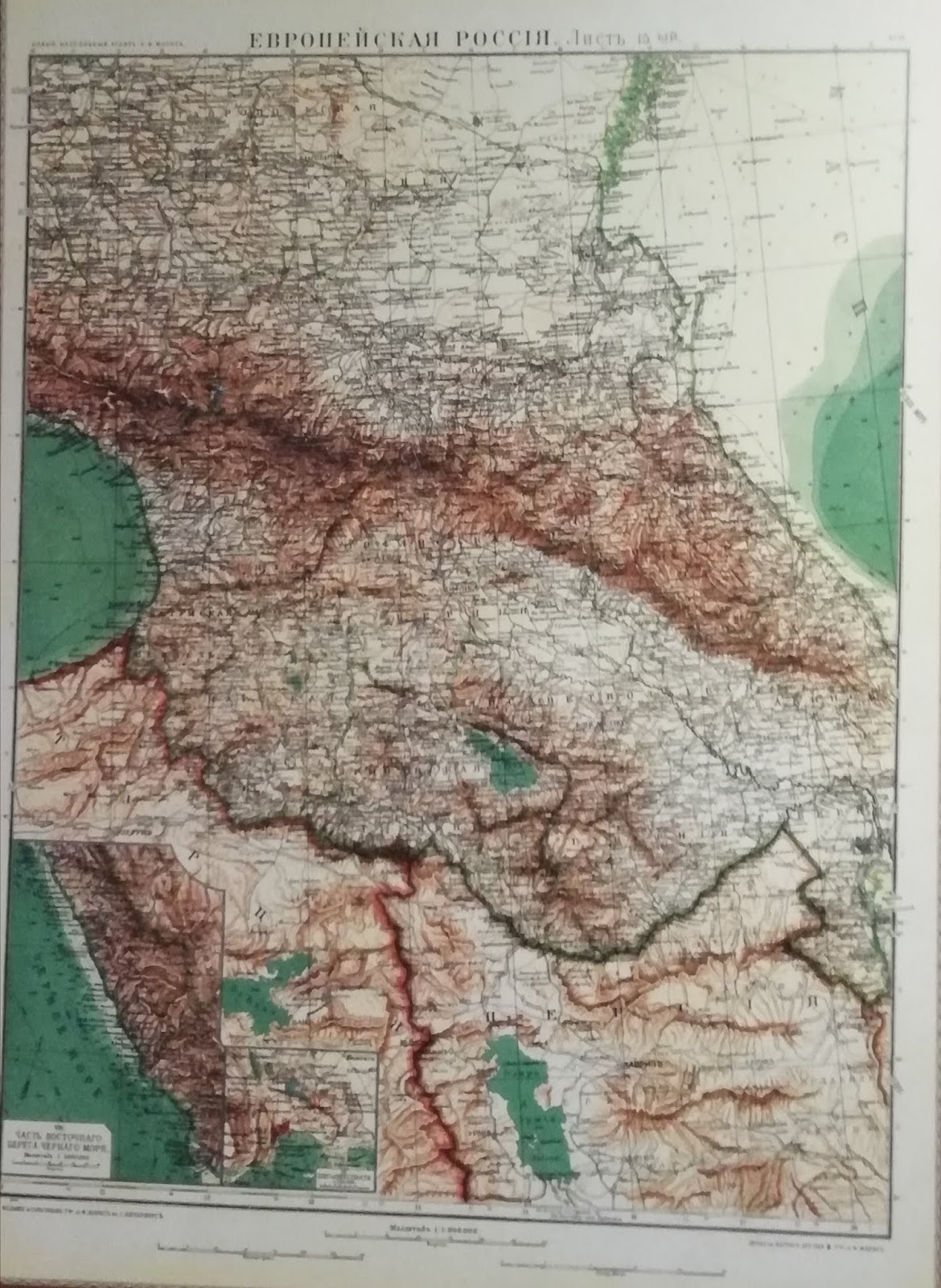
The map included to this blogpost was published in 1910 in Saint Petersburg, the capital of Russian empire. "A. F. Marks spciety" made big geographical atlas. It was named "Mark's Big World Table Atlas". That included in itself many maps of those times. Why we show this map in post. The main reason is that when we observe in this map - which were made by Russian geographers in Saint Petersburg - toponyms of modern Armenia are all in Azerbaijani language. There is no any Armenian words in the map in 1910. After Soviet occupatian of Azerbaijan, and creating Armenia SSR in the lands of Azerbaijan these toponyms were changed and armenized.
The map is being exhibited in the National Museum of History of Azerbaijan.


Comments

Popular posts from this blog

Salyan city, Azerbaijan

Salyan is the city in the central part of Azerbaijan Repuublic. The city of Salyan is an administrative centre of Salyan district (rayon) . Kura river divides the district into two parts. Historical Salyan region was much more bigger than nowadays rayon. It bordered by the Caspian Sea (nowadays Neftchala) and Kura river was flowing into the Caspian sea in the region. So, people of the region mostly was engaged in fishing. And in modern times Salyan is famous for its fish and fish meals, though most part of fish are gotten in Neftchala. In Soviet period Salyan was one of the industry region of Azerbaijan. With the city of Ali-Bayramly (Shirvan now) it made industry complex. After collapse of Soviet Union economy of Salyan  was destroyed. After ceasfire and economical reforns of preisdent H. Aliyev economy began to increase. Salyan oil company began to get oil in the territory of Salyan from 2001. Now Salyan city is one of the main cities of Azerbaijan connecting south and north part

Shah Tahmasib Safevid

Shah Tahmasib Safevid, son of Shah Ismail Khatai. He ruled after his father's death. Between Shah Tahmasib and Sultan Suleyman Kanuni had battles dyring their rules. Two great turkic states and their leaders were enemies of each other. These wars made Ottomans and Safevid empires weak and in ages they slowly dissappered from the scene. 

ОРНАМЕНТЫ КЕРАМИКИ ПЕРИОДА ПОЗДНЕЙ БРОНЗЫ В АЗЕРБАЙДЖАНЕ

ОРНАМЕНТЫ КЕРАМИКИ ПЕРИОДА ПОЗДНЕЙ БРОНЗЫ В АЗЕРБАЙДЖАНЕ Ключевые слова : Период поздней бронзы, орнаменты, керамика Территория Каваказа с древних пор играет роль моста соединяющего цивилизации Востока и Запада. Люди начали заселять эту территорию уже с периода палеолита. На территории Кавказа,и в частности в Азербайджане, который был центром возникновения нескольких археологических культур, протекали важные исторические процессы . Предметом изучения археологов, являются сложившиеся в период поздней бронзы Ходжалы-Кедабекская и Муганская археологические культуры . Характерной чертой этих культур, как и культур, более раннего периода, являются особенности керамики. Керамика периода поздней бронзы, наряду с орнаментами, дающими нам представление о культурной и духовной жизни, содержит также сведения о быте людей того периода. Ареал распространения Ходжалы-Кедабекской культуры охватывает западную часть Азербайджана-Гарабаг, Гянджа-Газахскую зону, а также прилегающие к Азер